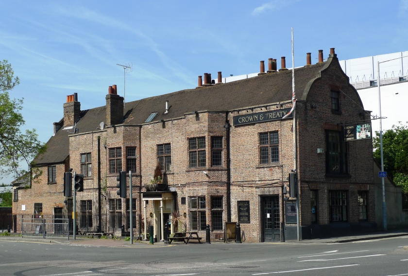
It was a jarring realization that the Uxbridge Treaty House is only a single surviving wing of a much grander original structure. This takes nothing away from the lovely existing building–it is a treasure, and feels complete on its own. But perhaps because it feels complete and seems to have always been perceived in variations of its current form, there remains little room to comprehend the true scale of the “fine house” and grounds that hosted the Peace Treaty Negotiations there in 1645. We can be forgiven having difficulty imagining it since (as we learned in my last article), among the mountain of images of his historic structure, not one of the original structure seems to have survived.
To better understand the historic event that took place there over nearly a month, I shifted my focus to sweeping together all the bits of clues I’d found and creating the best model I could of the original house. To my surprise, I have been able to integrate these many shards into a remarkably cohesive and durable model, including a fair portion of its interior arrangements.
You see, in its time, the original Treaty House and grounds were far more grand (and dominant) than what remains today would suggest. My research has led me to believe that to say that “the negotiations took place in a part of the house that has since been taken down” is much akin to presenting a single tire as a bicycle with some parts missing!
The Mystery of the Original Treaty House
Perhaps the most useful aspect of my Uxbridge research has been reinforcement of the need to remain wary of falling in love with a particular theory. There are nearly always breadcrumbs of information to be discovered, but what should we make of them? However, even chasing a theory that ultimately proves incorrect can be very useful. Nearly every time I have found myself officiating the frustrated funeral of an beloved theory, I’ve found the effort to validate it has led me to compelling insights I wouldn’t have come to any other way.
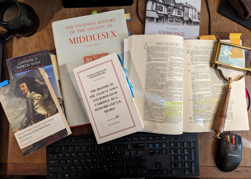
My search for clues regarding the form of the original Treaty House led me to a few important sources. The first is a remarkable 1818 book of Uxbridge history called “The History of the Ancient Town and Borough of Uxbridge” by G. Redford and T.H. Riches. This wonderful work contains the most significant (and well substantiated) record of the history of the house I have found. Captured by period historians in the early 1800’s, this book also includes many fascinating notes about the state of the town at that time. Reading this book two hundred years later, these glimpses into the early 1800’s Uxbridge inhabited by its authors were as interesting as the excellent historical research that was the focus of their work!
From the Riches/Redford book I have gathered the following important points:
- The original house was likely built sometime in the latter 1500’s (1576?). For much of its early history, this house was the seat of the Bennett family.
- The original house “which was then considerably larger than at present [i.e. 1818], stood in the centre of a large garden. The high road now [in 1818], passes through nearly the middle of the grounds.” Note: other sources I have found indicate the surviving building was roughly 1/3 of the original structure.
- The property was apparently partitioned in 1724.
- Following the death of the last Bennett (Leonora, Lady Bennett) in 1638, the property went through a handful of owners over the next century. At the time of the treaty negotiations in 1645, it was the property of a “Mr. Carr”.
The second source of critical information I added to my collection is one volume of a carefully written set analyzing the architectural history of the buildings of England. This particular volume is titled “The Buildings of England, London 3: North West” (1991). Amidst a sea of elaborately developed details about innumerable other important historic buildings, this remarkable book distills a history and architectural analysis of the Crown & Treaty into a single, un-illustrated paragraph at the bottom of page 363. I found this tiny account while following up on an obscure footnote from a different, modern architectural publication.
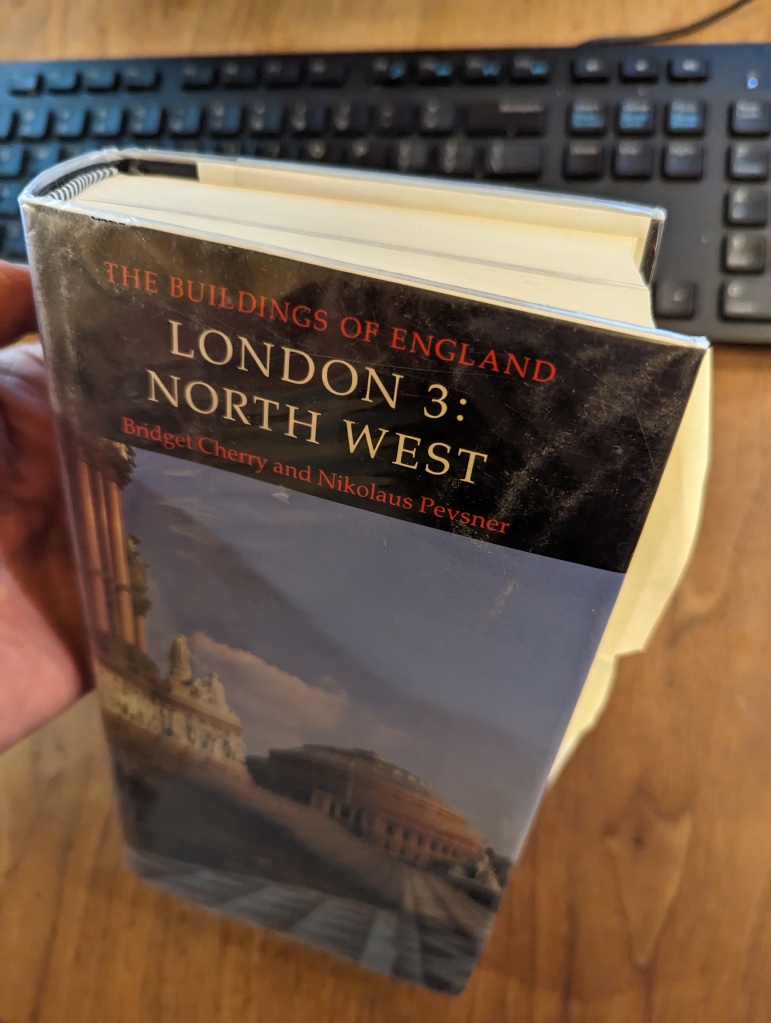
I laugh to myself at having had to purchase a book that is more than an inch thick (containing 804 pages) to access a single blurb of information that would almost fit on a business card. But that concise little blurb was absolutely worth the trouble and expense! Among a number of other useful details, it contained a singular critical clue I needed about the layout of the original Treaty House.
And so, in a passage that could likely be read aloud in a few breaths, I found the following gems:
- The Crown and Treaty was converted to an inn in 1802 after the property was purchased by the canal company to build a wharf for the Grand Canal. Note: the Grand Canal itself (which passes behind the Treaty House) was completed in 1793-4.
- About the building’s history, the book states, “The present building consists of one wing of the formerly half-H shaped Treaty House…”
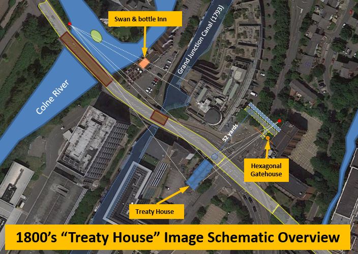
- The rest of the building “was demolished in the 1750’s, and the road was later diverted across the forecourt.” From another source I learned the roadbed had been moved 52 yards from its original path.
The third great resource I found was a book by John Rushworth which provides the following first hand account:
“This place being within the Parliament’s Quarters their Commissioners were the more civil and desirous to afford Accommodations to the King’s Commissioners, and they thought it fit to appoint Sir John Bennet’s House at the further end of the Town, to be fitted for the place of meeting for the Treaty.
The Fore-way into the House was appointed for the King’s Commissioners to come in at, and the Back-way for the Parliament’s Commissioners; in the middle of the House, was a fair great Chamber where they caused a large Table to be made like that heretofore in the Star-Chamber, almost square and without any upper or lower end of it. [note: another source indicates the negotiations room was on the upper floor].
The King’s Commissioners had one end and one side of the Table for them, the other side was for the Parliament’s Commissioners, and the end appointed for the Scots Commissioners to fit by themselves. Behind the Chair of the Commissioners on both sides sate the Divines and Secretaries, and such of the Commissioners as had not room to fit next to the Table.
At each end of the great Chamber was a fair Withdrawing-Room and Inner-Chamber, one for the King’s, and the other for the Parliament’s Commissioners to retire unto, and consult when they pleased.”
John Rushworth, ‘Historical Collections: The Treaty at Uxbridge, 1645
A Quick Aside: The Table at the “Star Chamber“
Rushworth’s observations about the negotiation table was a particularly valuable clue. A large square table had been custom made for the treaty negotiations. And, this table was “like that heretofore in the Star-Chamber”. But what does that mean? I think many of us have heard of the Star Chamber.
Aside from being a contender for the most intriguing name ever, the Star Chamber was both an actual room at Westminster Palace and also a colloquialism for the medieval “Court of Star Chamber” that gathered there. This infamous court is a tale of well-intentioned ideas gone horribly wrong. Conceived as as something like a Supreme Court, the Star Chamber served as a court of appeals from lower courts. It also had a second, very important purpose. Composed of a combination of privy councillors and senior judges of the common law, the Star Chamber was also charged with the task of hearing cases against those so powerful they were unlikely to ever be convicted by lower courts. The Star Chamber was an important step in the transition from the medieval to modern institutions of governance.
Lauded in its first few decades for its efficiency, flexibility and fairness, this special court was weaponized in the reign of Henry VIII as a tool of political oppression. Unfortunately, once begun, the abuse of this court’s power continued for more than a hundred years–well into the reign of King Charles I. The Court of Star Chamber was finally abolished by the rising parliament led by John Pym in 1641–one year before the start of the English Civil War.
John Pym was a busy man in 1641. Perhaps you remember him from my recent articles analyzing the “Trial of Strafford” painting that hangs in the House of Lords at Westminster? In that painting, Pym is depicted illuminated in mid-oration as he himself (successfully) weaponizes the House of Commons as an instrument of the assassination of a key supporter of King Charles I: the Earl of Strafford, Thomas Wentworth. Although Pym was the architect of the Parliament’s effort to wrest power of the government from the crown in the English Civil War, he was not among the parliamentary commissioners present at Uxbridge in 1645. He had died of illness a year before.
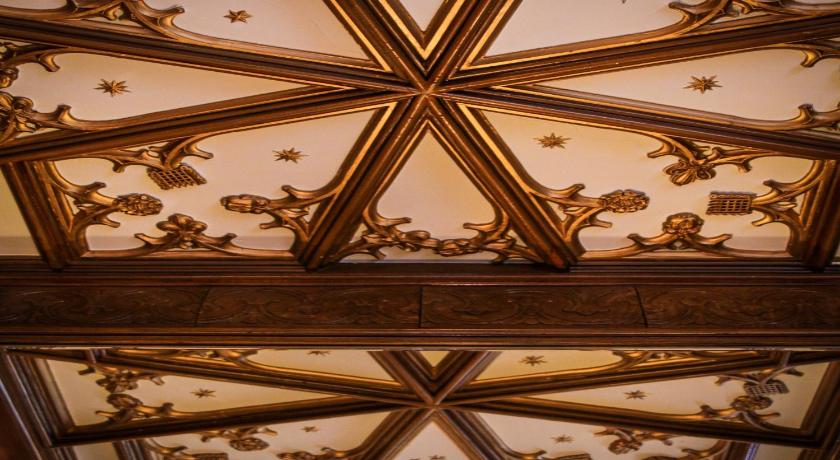
Ironically, the Rushford clue about the large square negotiating table at Uxbridge may be the only real clue about the original furnishing of the Star Chamber itself (except for the dark blue ceiling with ornate gold stars the chamber is named for). When the chamber was demolished in the early 1800’s the ceiling and tapestries were salvaged and taken to the Leasowe Castle on the coast of the Irish Sea near Liverpool. You can see this ceiling today if you stay at the Leasowe Castle Hotel!
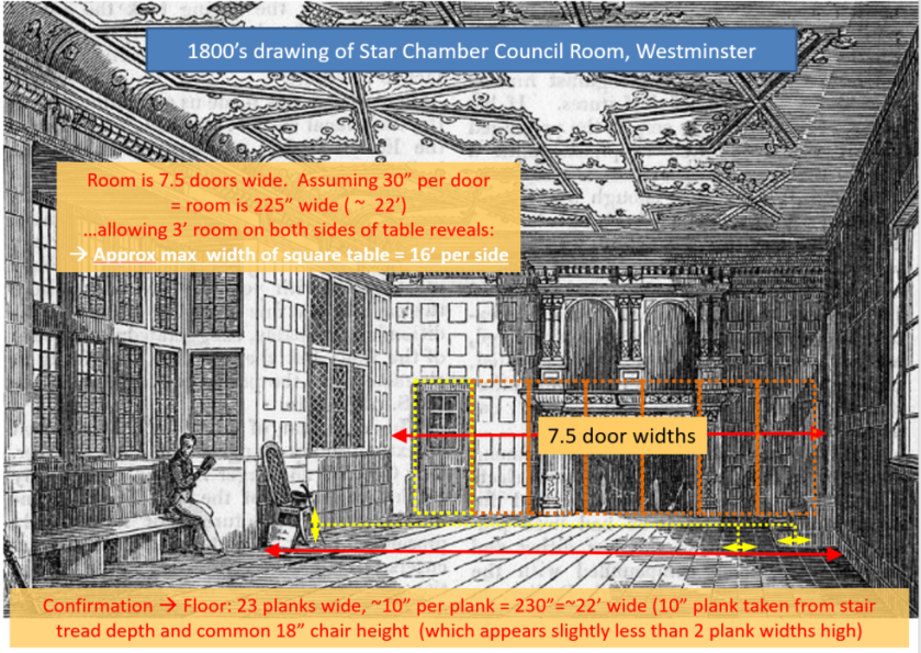
Looking at the drawing of the Star Chamber below, it seems that the room was rectangular, with the lesser dimension along the far wall. In this graphic, you can see the spatial analysis I used to estimate this room to be approximately 22 feet in width. Considering how large a table could occupy this space usably, I would estimate the table width could be as much as 16 feet on a side. Assuming humans have not dramatically changed their dimensions and allowing 2 feet per seated person, such a table would have seated as many as 8 people along each of its sides.
In Uxbridge, this would mean that roughly half of each side’s 32 commissioners (16 people) could have sat at the table, and at least this same number of seats behind the railings would have been required for the other half of the commissioners (and any other important attendees–the “Devines and Secretaries”). This is an important bit of information, as the size of this table and some idea of the minimum seating around it provides a defining bound on the minimum immediate space required to accommodate these negotiations.
First Model of the Original Layout of the Treaty House
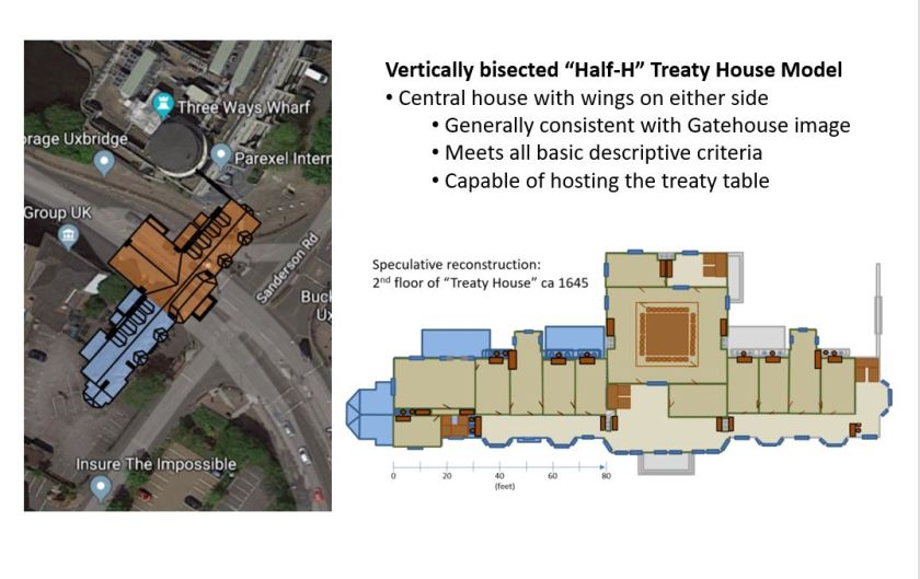
For awhile, I was convinced the “gatehouse” image discussed in my prior article could have been of the original Treaty House. Given that the original house was described as a “half H”, the question is: how do you split that “H”? Assuming it was split vertically, the wings would have been aligned along the same axis on either side of a center structure of the house (see the graphics of my first overhead model, below).
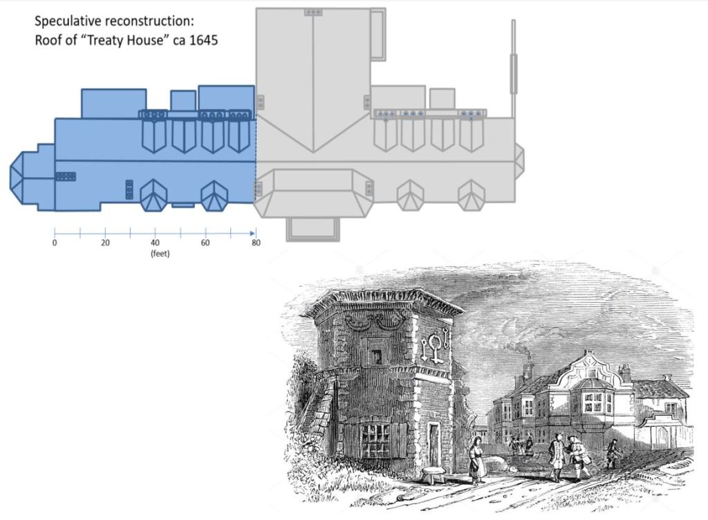
Under this assumption, the view from the gatehouse image would have been looking at the far end of the “other” wing, and the surviving wing of the structure would have been almost entirely hidden from view. In my second graphic, this overhead model is laid onto satellite imagery. From this overlaid image, it is apparent that this model certainly meets the criteria that the relocated Oxford Road passes “through the center” of the original house!
The second graphic reflects my modeling of the second floor of this version of the original building. The second wing is a mirror image of the existing wing. In the center section of the building, I continued the Elizabethan “gallery” along the front windows. I added fireplaces in reasonable locations to provide the ability to heat those spaces during cold weather. Given the size of what might have been originally conceived as a ballroom space, I added fireplaces in opposing walls for heating. Then, I identified reasonable stairwell locations and antechambers while leaving withdrawing spaces through which attendees could access the main chamber without interrupting discussions in the private chambers.
When doing such modeling, it is important to keep in mind that the model must make sense for the purposes such a building might have been originally designed to accommodate. Certainly, given its location in an inn-stop town along such an important road would have made it a good candidate for hosting official functions (such as circuit court proceedings, government meetings, etc). Also, hosting large entertainment events (such as balls or masques) would have had political benefits to the building’s owner. But perhaps more interesting to its architect would have been the prospect of creating a Middlesex venue that could host royal visits or other important events of state. Such an ambition would have been a natural motivation for the investments in the park-like grounds and attractive architecture of the building. The design of the gatehouse is far from merely functional–it was meant to impress! And if that had been part of architectural vision for this property, those investments had certainly paid off in 1645.
So how did this interior model feel? How well did it meet the criteria defined by the evidence I’d gathered? I gave it a solid maybe. It met the criteria, but the center building seemed a bit wide, raising concerns about how it could be supported structurally. The “withdrawing ” areas feel more cramped than implied, and narrowing the building would have made them even smaller. The original interior arrangement might have been like this, but it feels a bit forced.
Eventually, I determined there were two inescapable problems with this model. First, although the depiction details seem a bit “muddy” in the original version of the image I was working with, the left-facing protrusions in the image don’t quite align with the model. If the center of the house did not protrude beyond the primary wall of the wings, you would have seen all four bay windows of the wings in that line of sight. If it did protrude, the center section would have eclipsed the view of the two more distant bay columns, leaving three apparent protrusions from this viewpoint. The image only depicts two. In the end, I had to give the artist credit. This is an excellent depiction, and the artist that did it would not have gotten that detail wrong.
The second realization was a more definite discrepancy. In this arrangement, the face of the building nearest the artist in the gatehouse image would have been approximately 120 feet closer to the artist than the current, Oxford Road face is today (accounting for the width of the center section of the building and the length of the nearer wing combined). So, if the roadbed was moved 52 yards (or 156 feet) from its original location to its current location next to face of the surviving wing, the visible face of the original eastern wing would only have been about 40 feet from the original roadbed–which lay outside the wall. Of course, the nearest face of the building in the depiction is much further away than this.
My Second Model of the Original Treaty House
After I got a good sulk out of my system, my curiosity rose again, and I retrieved my frustration-flung papers from the floor. The vertically bisected layout was a non-starter. So what did that leave? It was time to reconsider the other way to interpret “half H” as the description of a shape. If the “H” were instead bisected horizontally, it produces a horseshoe-like shape. I had thought of this earlier, but had dismissed it as a non-intuitive way to describe this shape. But there really was no other remaining way to form a “half H”.
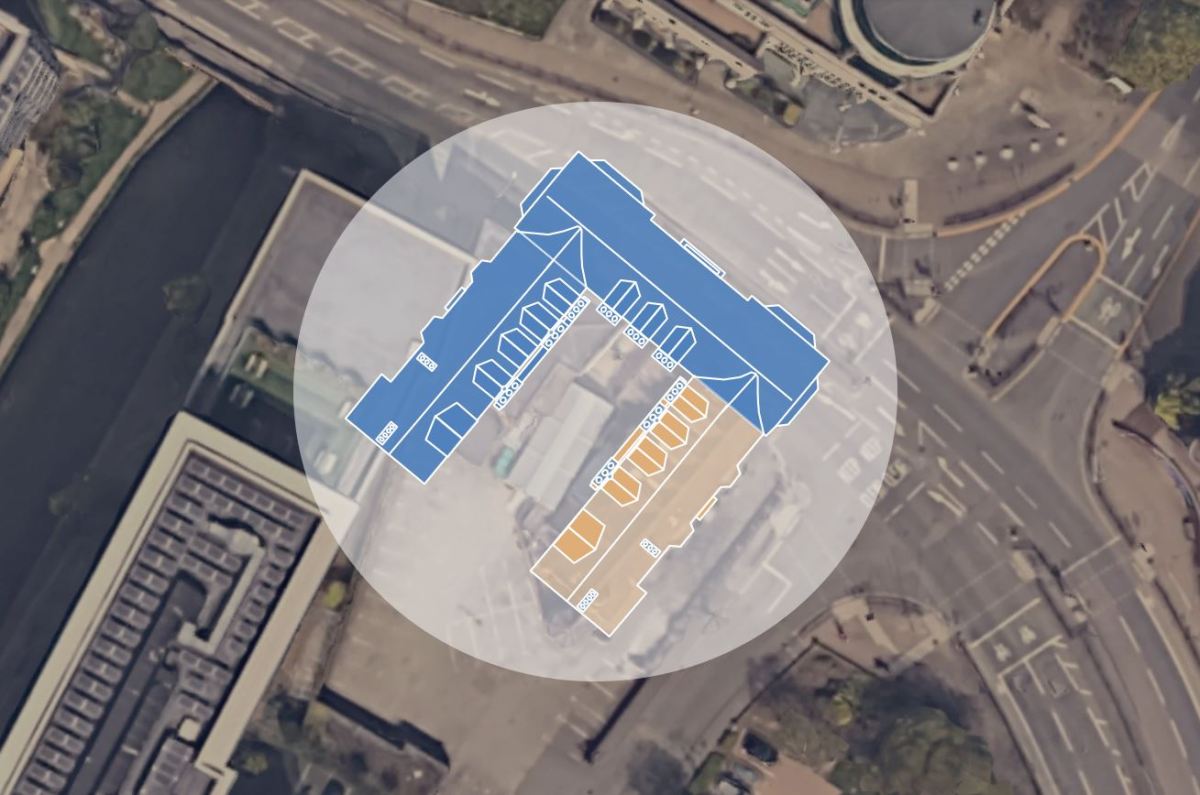
So I began work on my second reconstruction model, this time with two parallel wings joined by a center span at one end–forming a horizontally-bisected “half H”.
In this model, the two wings lie parallel to one another, and are mirror images of one another. Because the house was at the “center of a large garden”, the windows would have looked outward onto gardens from either wing. In this arrangement, the chimney sides of the two wings would have faced each other. Similarly, the center span would have also featured chimneys along its back wall and featured significant windows looking out over the portion of the gardens directly in front of the house.
Note that the center span could not have been at the other end of the wings. This would have formed the classic “E” arrangement where the front door lies within the arms of the wings. Also, in such an arrangement, the relocated Oxford Road would not have passed through the center of the original building.
The semi-enclosed space between the wings would have been interesting. The artful chimneys would have made it quite striking from the few windows available. But given the logistical realities of the time, I suspect this would have been a largely utilitarian space. At a minimum, it likely would have included wagon delivery parking and service doors for access to the kitchen and storage areas, a protected well for water and and protected storage for firewood.
In the next graphic, you can see my interior model of the building. As indicated in the notes I’ve gathered, the negotiations chamber was in the center section of the building on the upper (second) floor, as illustrated.
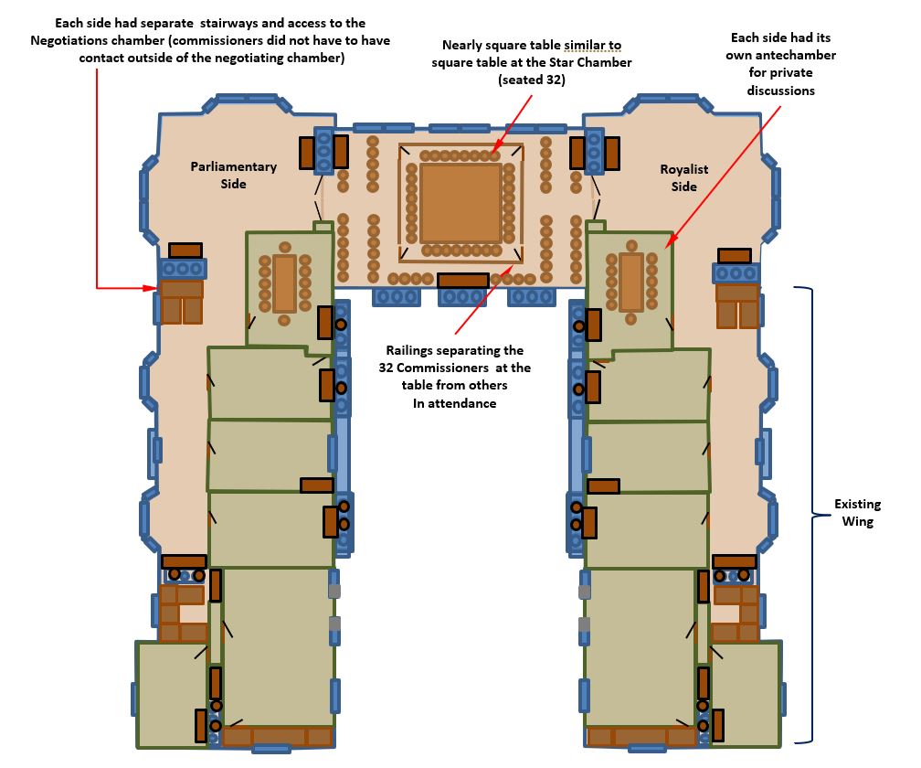
In this model, the Royalist commissioners would have entered through the center door on the right (surviving) wing. Since it was closer to town this would have reasonably been described as the “Fore-way”. The parliamentary commissioners would have walked around the building and entered via the side door on the opposite wing (the “back-way”). Each would have turned toward the center of the building and ascended stairs to the second floor, where they could choose to enter their antechamber(s) or the large windowed “withdrawing room” for their side.
When ready to join the negotiations, the commissioners would pass through ornate double doors to enter the central “ballroom”. Arrangements of elegant chairs lined either side of a path to the central railing. Entering through gates in the railing, the commissioners made their way to their seats at the expansive table. Much as the mythical “round table” imagined by Chaucer for King Arthur and his knights, this brilliantly conceived table had no “head” and so placed all the commissioners on respectfully equal footing during these talks.
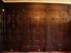
The surrounding walls of these spaces were likely fitted with the same famous rich panelling preserved in the surviving wing of the Treaty House. The walls were hung with many rich (likely official, state themed) tapestries to mark the occasion. Many-candled chandeliers above the table and sconces around the chamber provided most of the evening lighting, as the negotiations often did not end until after midnight. The rich, heavy drapes around the large windows were likely pulled closed as night fell, or as needed to trade away light for warmth during the bitter cold. When the drapes were open, the attendees could look out over the expansive gardens that lay between the house and high ornate wall standing more than 100 feet away. Within the chamber, the crackling of multiple fires provided islands of warmth to those gathered nearby.
Of course, there is some room for variance from this interior model, but perhaps not as much as you might think. With a gardens all around, and many windows facing them, the area nearest those windows would have generally been open in the Elizabethan gallery style. The pattern of fireplace placement with each room or space having at least one fireplace, plus orthogonally facing fireplaces at the boundaries of the large glassed in spaces) was taken from the existing structure and common practices with such galleries. The main “ballroom” would have been as large as possible, so this space would have been open completely between the outside walls (on the order of 30 feet wide).
Large closable doorways were probably situated between the central chamber and the large “withdrawing” areas on each side. This would have allowed flexibility in how the space was used. When open, these large doors would make the conjoined space space feel fairly continuous. When closed, such doors would allow the spaces to be isolated so they could be used separately and could be more effectively heated. Also, the wall structure such doors would have been built into was likely architecturally necessary to house fireplaces near the windows and load bearing columns to support the roof over such significant spans. Such columns needed to be placed somewhere, and the space in the middle of of the central room must have been unobstructed. Otherwise, it could not have accommodated the large table.
In my opinion, the most vulnerable details of this interior model are the placement of the stairs and the walls of the antechambers. For example, the staircases might reasonably have been located in the “withdrawing” areas and could have been implemented in any of several layouts. No matter where they were placed, these staircases would have been elegant. The more practical staff stairwells would have been located at the far end of the wings.
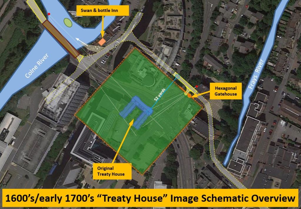
The next graphic is my model of the estate itself. Although the boundaries of the property could easily have been any among a variety of irregular polygons, the building’s location mid-way between the beds of the Colne and Frays rivers and the hint of equidistance in the description of the house (lying “at the center” of a large gardens) led me to assume a roughly square boundary for the estate wall with its sides aligned to the walls of the existing structure. Of course, the size of this square was yielded by the fact that this estate was bisected by the road, which had been moved “52 yards” to align it with the bridges crossing the Colne and the Grand Junction Canal and then Mercer’s bridge across the Frays stream. Geometrically, this would have made the walled-in grounds approximately 300-350 feet on each side.
Recently, I got a gratifying confirmation of this speculation. I came across a pair of 1825 maps of Uxbridge showing road details and also the township boundaries. The first is a map (below) of the roadways and primary buildings present in Uxbridge at that time (1825). I have overlaid a properly scaled square of my estimated estate walls and registered it against the red outline of the Treaty House footprint at that time. In this map, there is a spur in the roadway from High Street just after it crosses the Frays stream. from High Street. This spur (which I believe was a vestige of the original bed of the Oxford Road, traces a path directly around the corner of my estimated estate wall!
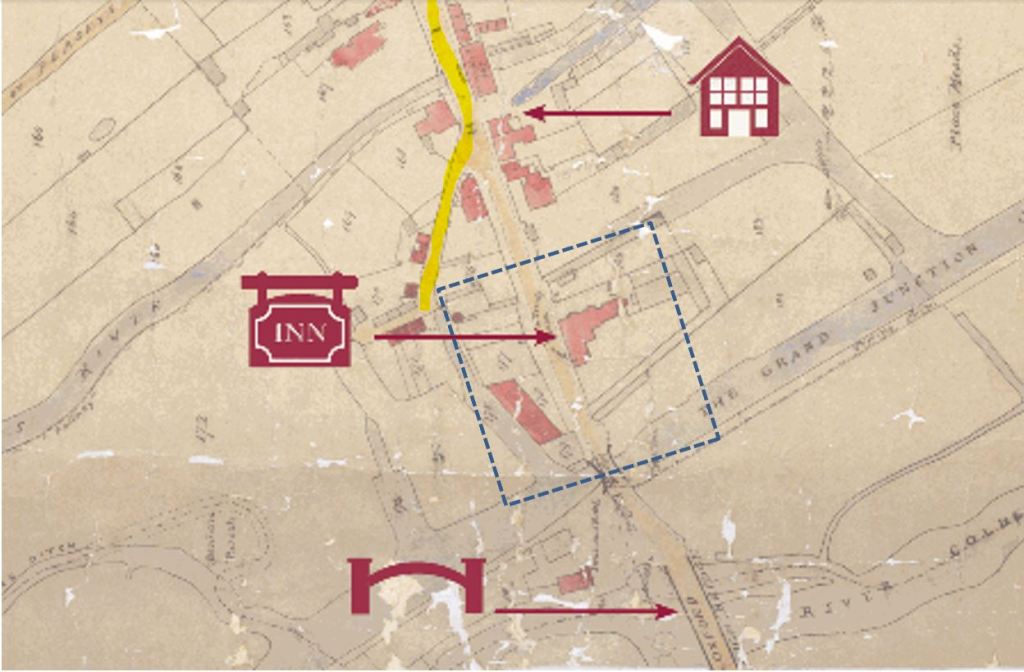
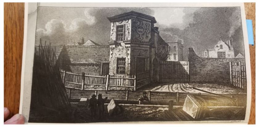
Even more interesting–look closely at that corner of the property. Do you see that small red dot just inside the dotted line? I suspect this was the footprint of the hexagonal gatehouse, apparently still in existence at this time. Lying next to that gatehouse you can also see the end of a light blue canal leading back to the Grand Canal. If this scene seems familiar, it should. This is exactly the scene in the middle 1800’s gatehouse drawings which depict a canal passing directly in front of the elegantly dilapidated hexagonal gatehouse, with the surviving Treaty House building in the background.
The next graphic is taken from a different 1825 map that illustrated the boundary of the Uxbridge township at that time. I had actually expected the property the Treaty House was built on to be much more elongated, extending to the South. I was a bit shocked to find the township boundary directly parallels the rear wall of the estate in my model of the grounds! This apparent extension of the township boundary (which otherwise lies to the east of the Frays stream) provides an interesting indicator of the footprint of the developed properties at that time.

To anyone who has ever owned and cared for horses for any period of time, leaving an apron of land beyond the walled-in part of the grounds wall makes perfect sense. Every time you “muck the stalls”, the cartload of horse manure and straw collected has to be dumped somewhere, and you would not want that inside the estate walls! Naturally, these estate walls would have included several utility gateways. Perhaps none was more utilized the one that would have been located near the outbuildings (and stables) at the rear of the walled-in estate. This “back-wall” gate would likely gotten significant use as manure carts, horses being grazed and wagons carrying firewood harvested from the commons passed through it.
That was a lot to cover, so if you made it this far, thanks for your interest in this work. Now, with the main course out of the way, it’s time for the dessert! In my next article, I will be presenting the wonderful, long sought image of the original Treaty House created by the talented artist helping me with this reconstruction.

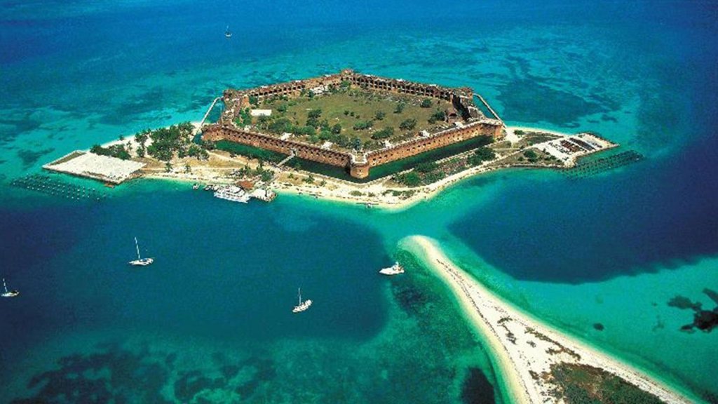
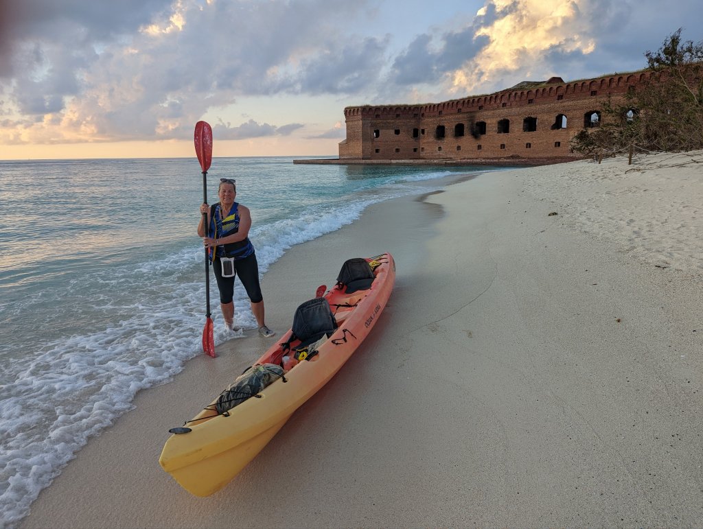
It’s great to be writing again, and it will be wonderful to turn my attention back the queue of other articles that has been on hold for so long. I’m adding this section to my articles to share some of the other interesting things competing for my time. Most recently, this was our “bucket list” adventure at “Dry Tortugas”.
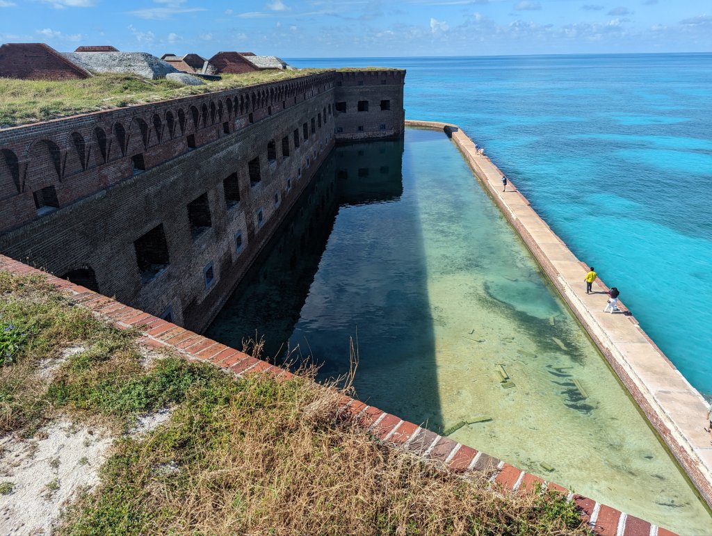
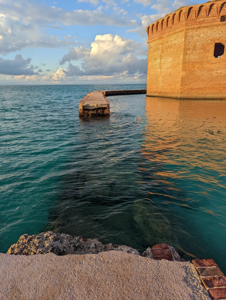
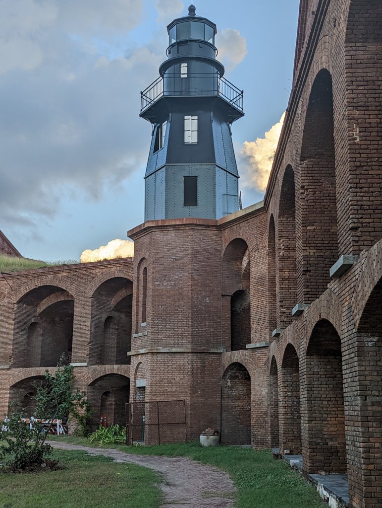
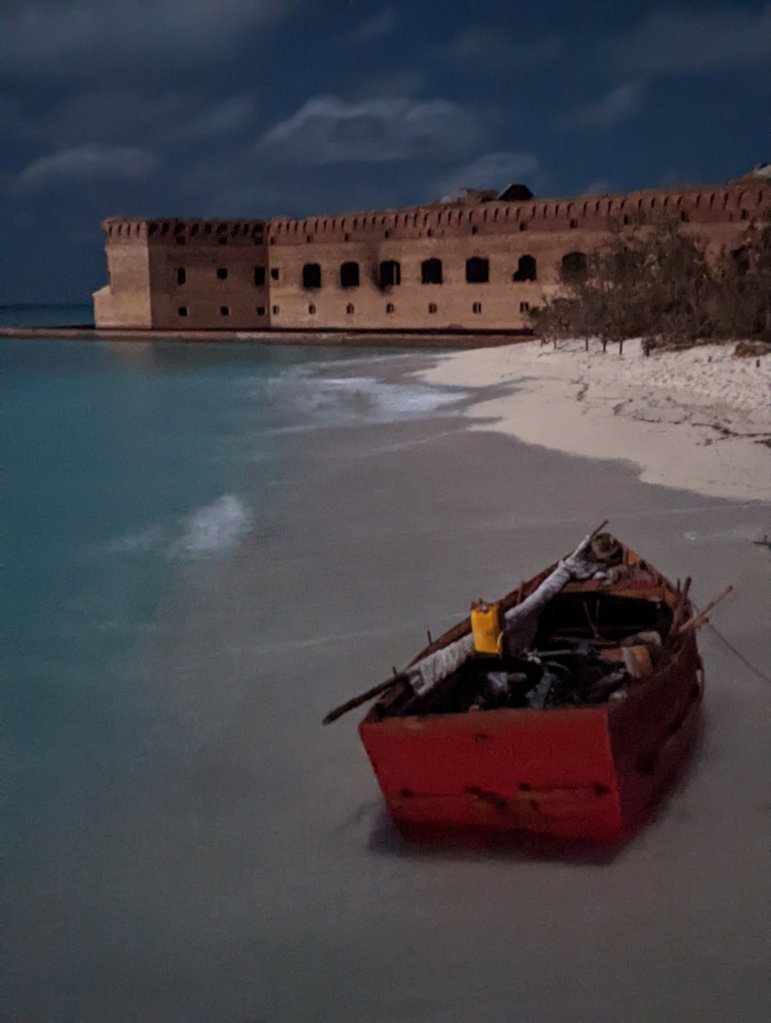
Dry Tortugas is America’s smallest national park. It is basically a large hexagonal brick fort from the 1700’s. This expansive fort almost completely covers a small spit of sand poking out of the Gulf of Mexico. fort Jefferson was a naval outpost built to support ships patrolling the gulf during the “golden age of pirates” of the late 1700’s. It lies 70 miles due West from Key West–the furthest island in the chain of “keys” at the very tip of Florida. A ferry boat makes a daily run to Dry Tortugas and provides the only services available there. Reservations on this ferry must generally be made a year in advance.
Along one side of the fortress walls there is a narrow strip of land you can camp on. After driving 2200 miles from Colorado (and dancing our way around hurricane Nicole) to get there, we camped and explored Dry Tortugas and a few neighboring keys for 3 fascinating days.
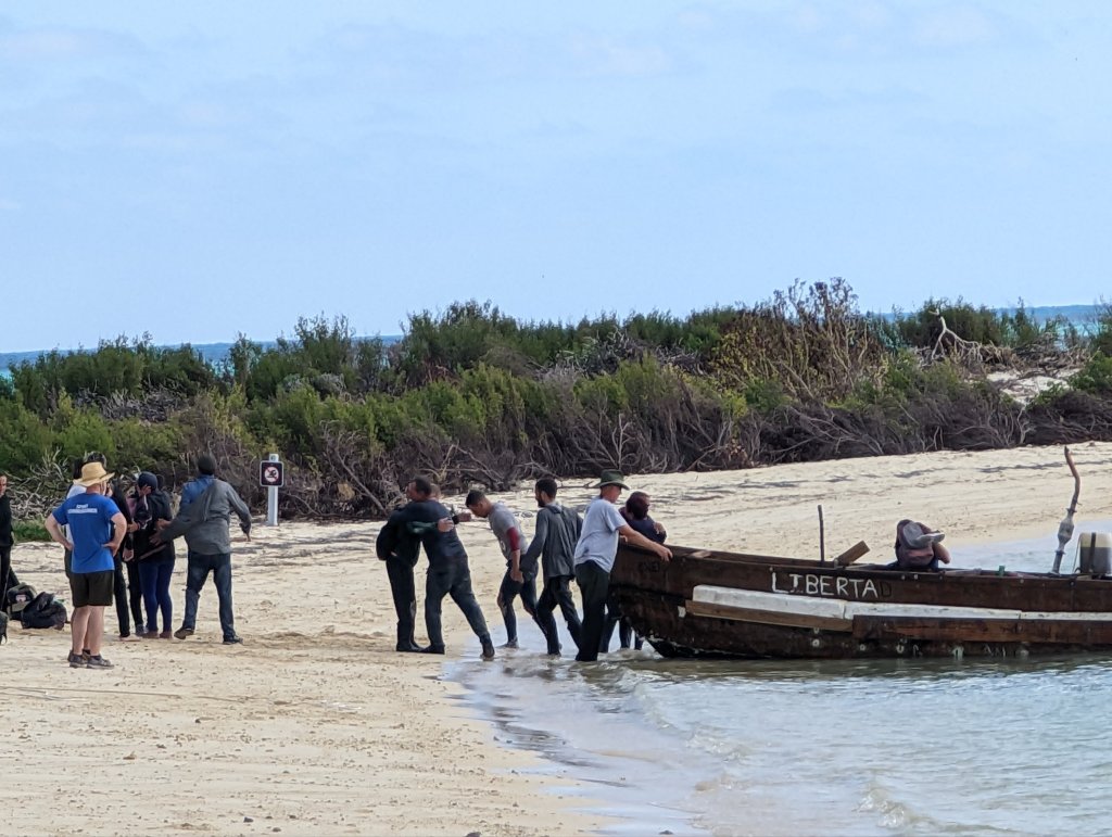
The unusual history and sea kayaking were as wonderful as we’d hoped, but we hadn’t expected to see migrant boats arriving from Cuba. It was moving. Nothing will make you appreciate what you have more than seeing someone fling themselves down to kiss the sand after a daring 100 mile open water crossing in an overcrowded, rickety boat–just for a chance of having it also…